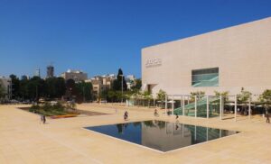
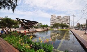
Park HaMesila is a linear public park in southwestern Tel Aviv built on the historic route of the Ottoman railway that once connected Jaffa to Jerusalem. The park stretches approximately 1.3 kilometers between the Neve Tzedek quarter and Eilat Street, covering 30 dunams of urban green space. After years of construction, this innovative park opened to the public in October 2020, transforming abandoned railway infrastructure into Tel Aviv’s newest recreational corridor.
The park represents a remarkable example of adaptive reuse in urban planning, converting what was once a barrier between neighborhoods into a unifying green spine that connects diverse communities. The project cost approximately 60 million shekels and involved extensive archaeological surveys, environmental remediation, and community consultation processes. The linear park serves multiple functions as a recreational space, ecological corridor, and historical monument, while also providing practical transportation routes for pedestrians and cyclists moving through the city.

Historical Background
The foundation of Park HaMesila traces back to the ambitious Ottoman railway project that connected Jaffa to Jerusalem when it was inaugurated in 1892. This 87-kilometer railway line was constructed under the direction of Joseph Navon, a Jerusalem businessman who secured the Ottoman concession in 1888, and was built by the French company Société du Chemin de Fer Ottoman de Jaffa à Jérusalem et Prolongements. The project required four years of intensive construction through challenging terrain, including the cutting of the railway trench that now houses the park.
During its operational period from 1892 to 1948, the Jaffa-Jerusalem railway served as a crucial transportation link, carrying pilgrims, merchants, and goods between the Mediterranean coast and the holy city. The line featured several intermediate stations, including one near what is now central Tel Aviv, and required significant engineering works including bridges, cuttings, and embankments. Steam locomotives manufactured by French and German companies pulled passenger carriages and freight cars along the narrow-gauge tracks, making the journey in approximately three to four hours depending on conditions and stops.
The railway’s decline began during the British Mandate period (1920-1948) as road transportation became more competitive and flexible. The line suffered damage during World War II and the subsequent civil conflict preceding Israeli independence. The railway’s active period came to an end following Israel’s War of Independence, when the section between Jaffa and Tel Aviv stations was demolished in 1950 as part of urban development priorities. The eastern sections toward Jerusalem continued operating until 1998, but the coastal urban portion was abandoned much earlier.
For decades, the abandoned railway corridor remained largely unused, creating a linear gap through the rapidly developing urban landscape of Tel Aviv. The railway trench, originally excavated to keep trains below street level, became an urban void that divided neighborhoods while also serving as an informal dumping ground and neglected space. During the 1990s and 2000s, urban development pressure increased around the corridor, with some sections threatened by construction projects.
The transformation from abandoned railway to public park began through grassroots community efforts and collaborative planning initiatives that recognized the potential of this unique urban space. Local residents, urban planners, and historical preservationists formed coalitions during the 2000s to advocate for the corridor’s preservation and conversion into public space. Years of planning, design work, and construction by the Kolker-Kolker-Epstein architectural firm, with landscape architecture by Dan Fox, culminated in the park’s opening. The Hebrew name “HaMesila” directly translates to “the railway” or “the track,” preserving the memory of the site’s transportation heritage while embracing its new identity as urban green space.
Inside Park HaMesila: What to See
Park HaMesila offers visitors a unique urban experience that combines historical preservation with modern recreational design. The park’s sunken position below street level creates an intimate, sheltered environment that feels removed from the bustling city above, while its linear design encourages exploration from end to end. The careful integration of preserved railway elements with contemporary landscaping creates a distinctive atmosphere that honors the site’s Ottoman-era origins while serving modern Tel Aviv’s recreational needs. The park’s design philosophy emphasizes sustainability, accessibility, and community engagement, with features designed to accommodate users of all ages and abilities.
Preserved Ottoman Railway Tracks — Multiple sections of the original 1892 narrow-gauge railway tracks remain in place throughout the park, serving as tangible connections to the 19th-century transportation network that once defined this corridor. These inactive tracks, measuring 1,050mm gauge as was standard for Ottoman railways, are integrated into the park’s design as both historical artifacts and landscape elements. Visitors can walk alongside or across the rails that once carried French-built steam locomotives and passenger carriages between Jaffa and Jerusalem. The preservation of these tracks provides a direct link to the Ottoman period and helps visitors understand the scale and engineering of the original railway project. Information panels along the tracks explain the construction methods, the types of trains that operated, and the railway’s role in connecting Palestine’s major cities during the late 19th and early 20th centuries.
Historic Shlush Bridge — This 19th-century stone bridge represents one of the most significant architectural remnants from the railway’s active period, constructed using locally quarried Jerusalem stone and Ottoman-era masonry techniques. The bridge, which once carried the railway line across what is now part of the urban landscape, has been preserved and incorporated into the park design as a focal point and historical landmark. Visitors can examine the Ottoman-era stonework and engineering techniques, including the characteristic arch construction and drainage systems, while understanding how this structure functioned within the broader railway network. The bridge’s restoration involved careful cleaning and repointing of the original stonework, with minimal intervention to preserve its authentic character and materials.
Sunken Railway Trench — The original below-street-level railway corridor creates the park’s most distinctive feature, providing a green canyon effect that shields visitors from urban noise and traffic while creating a unique microclimate. This natural depression, excavated by Ottoman engineers and workers between 1888-1892, now houses walking paths, vegetation, and recreational areas while maintaining its historical dimensions and scale. The trench design creates distinct zones and intimate spaces that feel dramatically different from street-level Tel Aviv, offering refuge and tranquility within the urban environment. The varying depths of the trench, from shallow cuts to sections nearly four meters below street level, create diverse environments and viewing perspectives throughout the park’s length, with some areas feeling almost rural in character despite their urban setting.
Walking and Cycling Paths — Dedicated pedestrian walkways and bicycle paths run the full 1.3-kilometer length of the park, providing safe, car-free routes for recreation and commuting through distinct surface treatments and design elements. These paths are constructed with permeable materials to manage stormwater runoff and feature lighting systems for evening use. The pedestrian routes include both main thoroughfares and smaller branching paths that lead to seating areas and viewpoints, while the cycling paths are designed to accommodate both recreational riders and commuters with appropriate width and gradient standards. The linear nature of these paths makes the park ideal for jogging, cycling, or simply taking a lengthy urban walk through changing neighborhoods and landscapes, with distance markers and wayfinding signs helping visitors navigate the full route.
Elifelet Light Rail Station — The modern light rail station integrated into the park represents the continuation of the site’s transportation legacy, as Tel Aviv’s Red Line brings rail transit back to this historic corridor after a 70-year absence. The station’s design harmonizes with the park’s aesthetic while providing practical transit connections for residents and visitors through carefully coordinated architectural and landscape design. This integration of past and present transportation infrastructure creates a unique juxtaposition between Ottoman-era railway heritage and contemporary urban transit solutions, with the new electric light rail system serving some of the same neighborhoods once connected by steam trains. The station features interpretive displays about the original railway and its connection to the current transit system.
Native Vegetation and Green Spaces — Carefully planned plantings of native Mediterranean species and mature trees provide natural shade and create diverse environments throughout the park’s length, including drought-resistant plants adapted to Israel’s climate conditions. These green spaces are designed to support local wildlife while offering visitors respite from Tel Aviv’s urban intensity, featuring species such as carob trees, native palms, wildflower meadows, and aromatic herbs. The vegetation changes character along the park’s route, creating different atmospheres and experiences as visitors move from one end to the other, with some areas more densely planted to create intimate groves while others remain more open and park-like with expansive lawns. Irrigation systems use recycled water, and the plantings are designed to require minimal maintenance while providing year-round visual interest and seasonal changes.
Recreational and Dining Areas — Popular establishments like Teder, Lava pasta restaurant, and Mirage restaurant have opened along the park route, creating social hubs that activate the space throughout the day and evening while contributing to the area’s economic vitality. Children’s playgrounds feature custom-designed equipment that incorporates railway themes and historical references, while picnic areas provide family-friendly facilities with tables, shade structures, and nearby restroom facilities. The park’s design accommodates both active recreation and passive relaxation, with fitness stations, open lawn areas for informal sports, quiet reading nooks, and community gathering spaces. These amenities ensure that the park serves diverse community needs while maintaining its character as a linear green corridor that connects different neighborhoods and cultural districts.
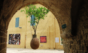
Art Installations and Cultural Features — Throughout the park, contemporary art installations and historical markers create points of interest and cultural engagement, including sculptural elements that reference the railway’s history and the site’s transformation. The park features extensive graffiti work that adds artistic flair to the urban environment, created with permission from the Tel Aviv municipality as part of the park’s cultural programming. These colorful murals and street art pieces contribute to the park’s vibrant character while providing a canvas for local and visiting artists to express their creativity in an officially sanctioned space. Information panels in Hebrew, Arabic, and English provide historical context and explain the park’s development process, while QR codes link to additional digital content about the Ottoman railway and its significance. Community bulletin boards and performance spaces accommodate local cultural events and activities, making the park not just a recreational facility but also a venue for cultural expression and community programming.