The Jesus Trail is a 65-kilometer hiking and pilgrimage route in the Galilee that connects significant sites from Jesus's life and ministry. The trail runs from Nazareth to Capernaum, passing through Cana, the Horns of Hattin, and other biblical locations where Jesus preached and performed miracles.
The Jesus Trail offers a unique 65 kilometer (40 mile) hiking and pilgrimage experience through Israel’s Galilee region, connecting the key locations where Jesus lived and ministered during the first century. This carefully designed route follows the geographic path described in the Gospel of Matthew, where Jesus “left Nazareth and went and lived in Capernaum” to begin his public ministry.
The trail takes hikers through landscapes virtually unchanged since ancient times, passing olive groves, wheat fields, and rocky hillsides that would have been familiar to Jesus. Along the way, walkers encounter diverse communities including Arab villages, Jewish kibbutzim, and Druze settlements, reflecting the multicultural character of the modern Galilee while connecting with its biblical past.

The Jesus Trail History and Significance
The biblical foundation for the Jesus Trail comes from Matthew 4:13, which records that Jesus “left Nazareth and went to live in Capernaum, which was by the lake in the area of Zebulun and Naphtali.” This geographical movement from Jesus’ childhood home to his ministry headquarters forms the backbone of the modern hiking route, connecting locations mentioned throughout the Gospels.
The modern trail was conceived in 2007 through the collaboration of Maoz Inon, a Jewish Israeli entrepreneur and peace activist, and David Landis, an American Christian hiking expert. Their vision was to create a world-class pilgrimage route comparable to the Camino de Santiago in Spain or the Saint Paul Trail in Turkey, but uniquely focused on Jesus’ life and ministry in the Galilee.
The physical trail was marked and opened to the public in 2008, following extensive negotiations with local landowners, municipalities, and religious authorities. The project operates as a non-profit initiative, maintained by volunteers and supported by donations. Since its opening, thousands of pilgrims, hikers, and cultural tourists from around the world have walked portions or all of the trail, contributing to local economies while fostering interfaith dialogue and understanding.


Jesus Trail sections: A Detailed Overview
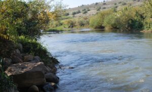
The Jesus Trail Galilee route connects the major sites associated with Jesus’ life and ministry: Nazareth, Sepphoris, Cana, Hattin, Arbel National Park, the Sea of Galilee, Capernaum, Tabgha, and the Mount of Beatitudes. An extended return route includes Tiberias, the Jordan River, Mount Tabor, and Mount Precipice.
The trail follows white and orange blazes marking the official route, with blue blazes indicating connecting paths and detours. Most sections require moderate fitness levels, though summer temperatures can exceed 35°C (95°F), making spring and autumn optimal seasons. Early morning starts are essential during warmer months. Water sources are available along the route, but carrying extra water remains crucial for safety.
The following four-day itinerary represents the most popular approach to hiking the Jesus Trail Galilee, though many variations exist. Official route recommendations provide additional options including shorter segments and alternative paths suited to different interests and abilities.
Day 1: Nazareth to Cana via Sepphoris
- Distance: 15 kilometers (9.3 miles)
- Difficulty: Moderate, with steady climbs
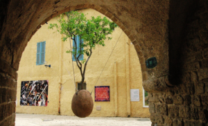
- Route: The trail begins at the Church of the Annunciation in central Nazareth, where Gabriel announced to Mary she would bear Jesus. The town, mentioned 17 times in the New Testament, remains Israel’s largest Arab city with 80,000 residents. After ascending the ridge above Nazareth, the trail crosses agricultural fields to reach Tzippori National Park, site of ancient Sepphoris. This Roman administrative center, just 6 kilometers from Nazareth, features spectacular Byzantine mosaics including the famous “Mona Lisa of the Galilee” in a third-century villa. The day concludes in Kafr Kanna (Cana), where tradition places Jesus’ first miracle of turning water into wine. The Wedding Church contains ancient stone jars similar to those described in John’s Gospel. Practical Information: Tzippori National Park admission is 29 NIS ($8.50) for adults. Open daily 8:00 AM to 4:00 PM (5:00 PM in summer). Free parking available.
Day 2: Cana to Kibbutz Lavi
- Distance: 17 kilometers (10.5 miles)
- Difficulty: Moderate, with extended uphill sections
- Route: Leaving Cana, the trail winds through the forests and agricultural terraces near Tur’an village, climbing toward the Horns of Hattin. These distinctive twin peaks witnessed Saladin’s decisive victory over the Crusaders on July 4, 1187, effectively ending Frankish control of the Holy Land. The extinct volcanic cones rise 300 meters above the surrounding plain, offering panoramic views across the Galilee. Archaeological excavations have uncovered Bronze Age settlements and later Roman-era remains. The day ends at Kibbutz Lavi, established in 1949 by Orthodox British immigrants as Israel’s first religious kibbutz. Practical Information: Horns of Hattin is accessible year-round with no admission fee. Kibbutz Lavi offers guesthouse accommodations and kosher meals. Reservations recommended during peak seasons.
Day 3: Kibbutz Lavi to Moshav Arbel
- Distance: 15 kilometers (9.3 miles)
- Difficulty: Moderate with steep descents toward the Sea of Galilee
- Route: The trail first approaches Nabi Shu’ayb, the most sacred Druze shrine, believed by the Druze to be the burial place of Jethro, Moses’ father-in-law. While non-Druze cannot enter the shrine, the surrounding area provides views of the Horns of Hattin battlefield. The path then descends toward the Sea of Galilee, passing ancient terraces and Mediterranean oak forests. Moshav Arbel, established in 1949, provides spectacular views over the lake from the Arbel cliffs. These limestone escarpments contain caves where Jewish rebels hid during the Great Revolt against Rome (66-73 CE). the Negev desert Arbel National Park protects the area’s unique ecosystem and archaeological remains. Practical Information: Arbel National Park admission is 22 NIS ($6.50). Open daily 8:00 AM to 4:00 PM (5:00 PM in summer). Climbing gear not required for main trail, but cliff access requires caution.
Day 4: Moshav Arbel to Capernaum via Mount of Beatitudes
- Distance: 18 kilometers (11 miles)
- Difficulty: Moderate with varied terrain
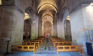
- Route: The dramatic descent from Arbel leads to Magdala (ancient Migdal), hometown of Mary Magdalene. Recent excavations have revealed a first-century synagogue where Jesus may have taught, along with the famous Magdala Stone, carved with Temple imagery. The Magdala Center displays these discoveries alongside modern pilgrimage facilities. The trail continues along the lakeshore through Kibbutz Ginosar, home to the 2,000-year-old Jesus Boat discovered in 1986. At Tabgha, the Church of the Multiplication commemorates the feeding of the 5,000 with exquisite Byzantine mosaics. The nearby Mount of Beatitudes marks the traditional site of the Sermon on the Mount. The trail concludes at Capernaum, Jesus’ adopted hometown, where extensive ruins include a fourth-century synagogue built over earlier foundations.
Additional Information
Jesus Trial Downloadable Map
Book: Hiking the Jesus Trail and Other Biblical Walks in the Galilee
The Jesus Trial Wikipedia
How long does it take to complete the Jesus Trail in Galilee?
Most hikers complete the full Jesus Trail in 4 days, covering approximately 65 kilometers (40 miles) at a comfortable pace. This allows time to visit the biblical sites, churches, and archaeological locations along the route. Many pilgrims choose to extend their journey to 5-6 days to include additional prayer time or rest days at significant locations like Nazareth or Capernaum.
What is the best time of year to hike the Jesus Trail Galilee?
The optimal seasons are spring (March-May) and autumn (September-November) when temperatures range from 15-25°C (59-77°F) and rainfall is minimal. Summer hiking is possible but requires very early starts due to temperatures often exceeding 35°C (95°F). Winter offers cooler conditions but increased rainfall, particularly December through February.
Do I need a guide to walk the Jesus Trail?
The Jesus Trail is well-marked with white and orange blazes and can be walked independently using official maps and GPS coordinates. However, licensed tour guides provide valuable historical context, biblical interpretation, and access to sites that might otherwise be missed. Many pilgrims find guided portions enhance their spiritual and educational experience.
Where can I stay overnight along the Jesus Trail route?
Accommodation options include guesthouses in Nazareth and Tiberias, Kibbutz Lavi’s hotel, the Fauzi Azar Inn in Nazareth’s Old City, and various bed-and-breakfast establishments in Cana and along the Sea of Galilee. Camping is possible in designated areas, though advance permission from landowners is often required. Many locations offer both budget and luxury options.
What should I pack for hiking the Jesus Trail in Galilee?
Essential items include sturdy hiking boots, sun protection, multiple water bottles (minimum 3 liters per day), lightweight rain gear, modest clothing for religious sites, and a basic first aid kit. Trail maps and GPS device or smartphone with offline maps are highly recommended. During summer months, electrolyte supplements become crucial due to heat and exertion.